Warning! Unfortunately your browser has disabled scripting. Please enable it in order to display this page.

Property Details

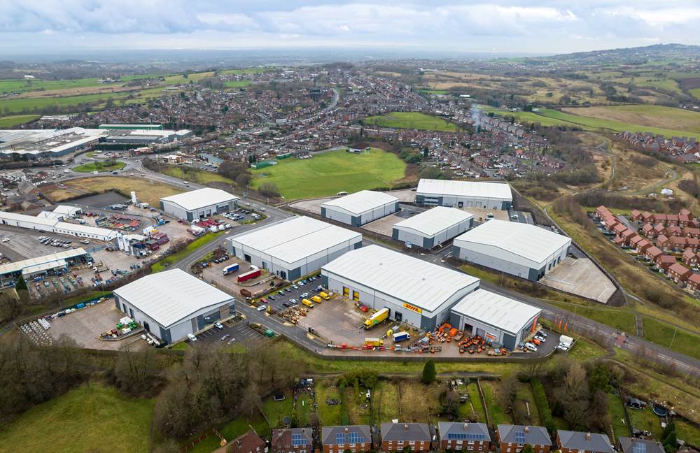
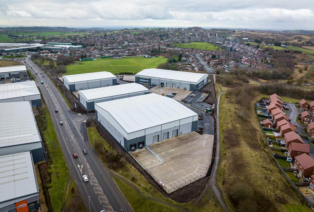
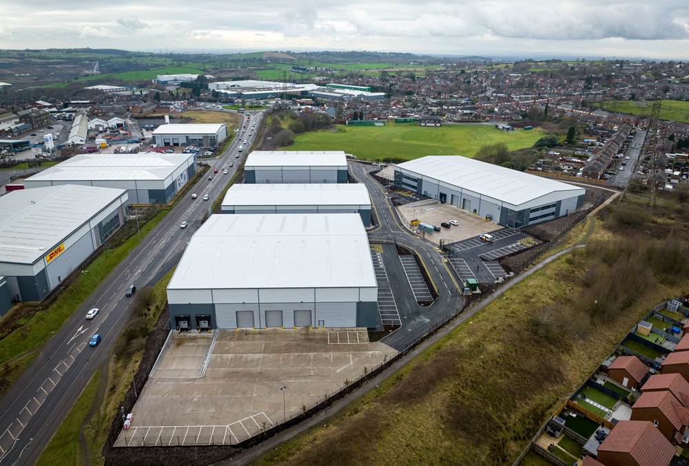
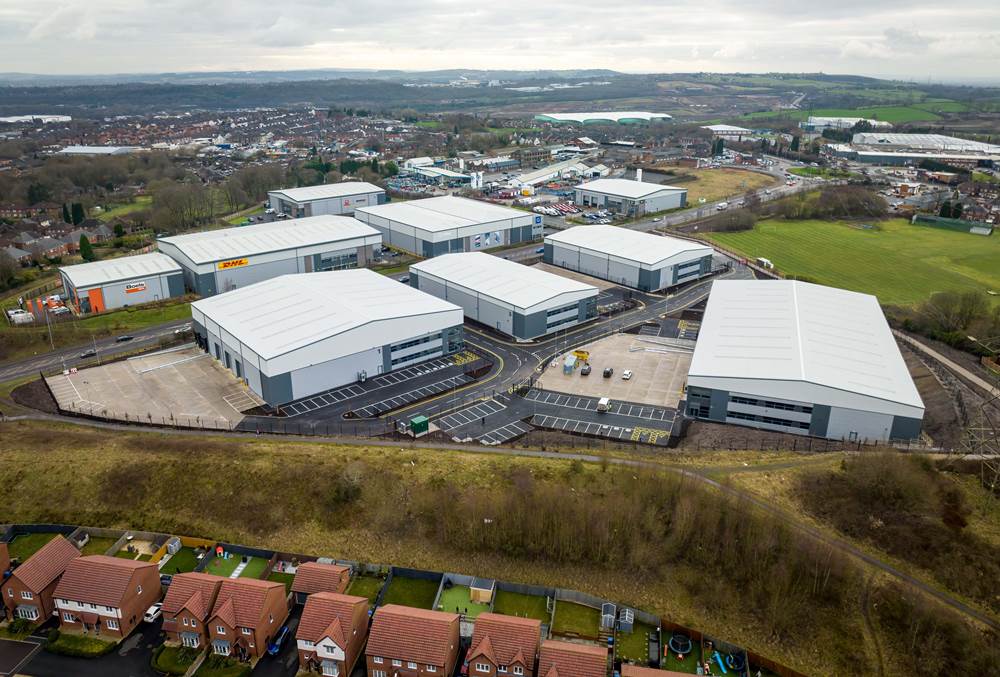
Network Space has completed the second phase of the Tunstall Arrow development, delivering 111,400 sq ft of industrial workspace on a 7- acre plot.

Tunstall Arrow is a 28 acre former colliery site adjoining the A527 (James Brindley Way) in Sandyford, Stoke-on-Trent. It was acquired by Network Space in 2013. The site is within close proximity of the A500, providing access to Junction 16 of the M6 within minutes. 

This second phase delivered five high specification, self-contained units ranging from 13,500 to 31,200 sq ft. It has now been sold to 4th Industrial, which also acquired the 127,100 sq ft first phase in 2021.

Both phases have been built speculatively by NSD with rapid take up by occupiers demonstrating the quality of the scheme and strength of the local market.  The scheme has attracted a host of international tenants including: DHL Express, Boels Rental, Q-railing, Pramac Generac and SG Fleet. Phase 1 was fully let within 3 months of completion and Phase 2 secured its first letting to Speedy Services, the UK's leading tools and equipment hire services company which operates across the construction, infrastructure and industrial sectors, with other units now under offer. 

The development is supported by Stoke-on-Trent City Council’s Ceramic Valley Enterprise Zone (CVEZ) initiative, and is making a significant positive impact on the locality - regenerating a former brownfield site, attracting inward investment and providing space for around 400 jobs.

Acquired by NSD in 2013, the overall Tunstall Arrow scheme covers 28 acres of a former colliery site adjoining the A50 and the A527 (James Brindley Way) in Sandyford. The scheme is close to the A500 with access to Junction 16 of the M6 only minutes away.


Map

[ { "featureType": "water", "elementType": "geometry", "stylers": [ { "color": "#e9e9e9" }, { "lightness": 17 } ] }, { "featureType": "landscape", "elementType": "geometry", "stylers": [ { "color": "#f5f5f5" }, { "lightness": 20 } ] }, { "featureType": "road.highway", "elementType": "geometry.fill", "stylers": [ { "color": "#ffffff" }, { "lightness": 17 } ] }, { "featureType": "road.highway", "elementType": "geometry.stroke", "stylers": [ { "color": "#ffffff" }, { "lightness": 29 }, { "weight": 0.2 } ] }, { "featureType": "road.arterial", "elementType": "geometry", "stylers": [ { "color": "#ffffff" }, { "lightness": 18 } ] }, { "featureType": "road.local", "elementType": "geometry", "stylers": [ { "color": "#ffffff" }, { "lightness": 16 } ] }, { "featureType": "poi", "elementType": "geometry", "stylers": [ { "color": "#f5f5f5" }, { "lightness": 21 } ] }, { "featureType": "poi.park", "elementType": "geometry", "stylers": [ { "color": "#dedede" }, { "lightness": 21 } ] }, { "elementType": "labels.text.stroke", "stylers": [ { "visibility": "on" }, { "color": "#ffffff" }, { "lightness": 16 } ] }, { "elementType": "labels.text.fill", "stylers": [ { "saturation": 36 }, { "color": "#333333" }, { "lightness": 40 } ] }, { "elementType": "labels.icon", "stylers": [ { "visibility": "off" } ] }, { "featureType": "transit", "elementType": "geometry", "stylers": [ { "color": "#f2f2f2" }, { "lightness": 19 } ] }, { "featureType": "administrative", "elementType": "geometry.fill", "stylers": [ { "color": "#fefefe" }, { "lightness": 20 } ] }, { "featureType": "administrative", "elementType": "geometry.stroke", "stylers": [ { "color": "#fefefe" }, { "lightness": 17 }, { "weight": 1.2 } ] } ]