Warning! Unfortunately your browser has disabled scripting. Please enable it in order to display this page.

Property Details

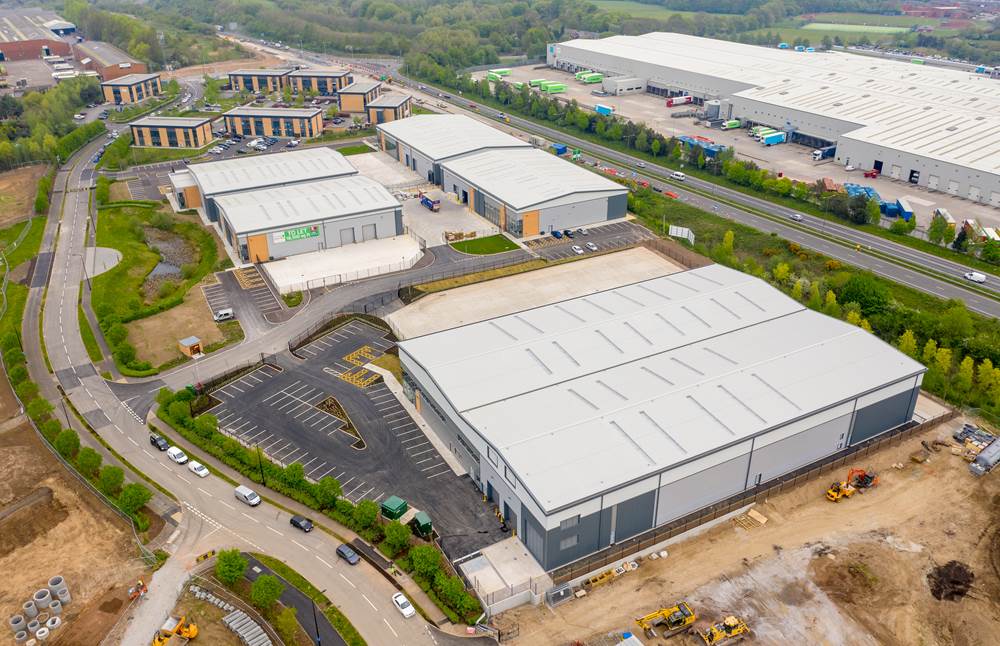
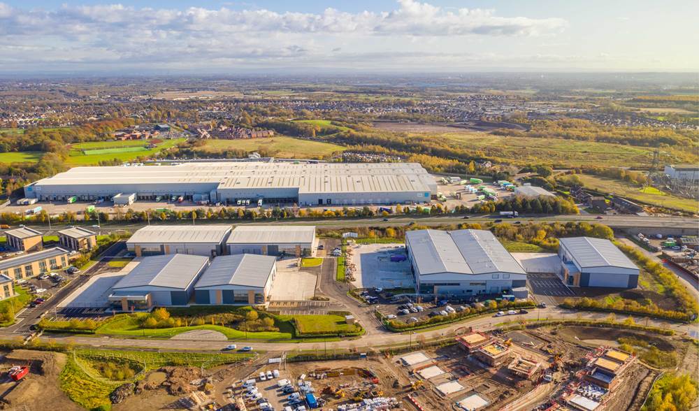
Mere Grange is a mixed use site incorporating a mix of office, industrial and residential development.

The 30 acre site in St Helens, Merseyside lies adjacent to the St Helens Linkway, close to Junction 7 of the M62.

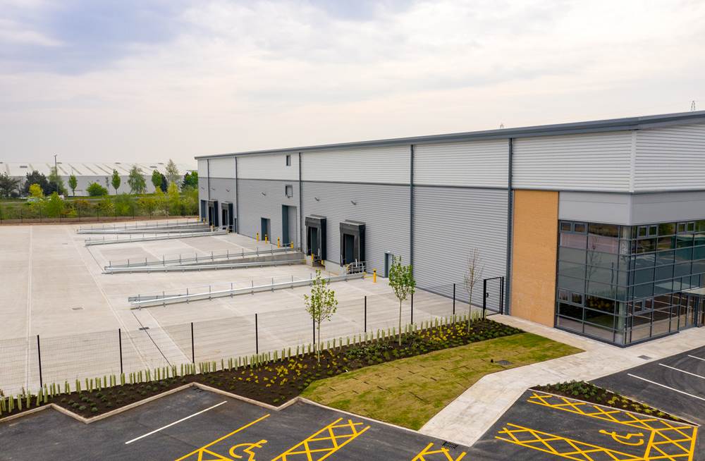
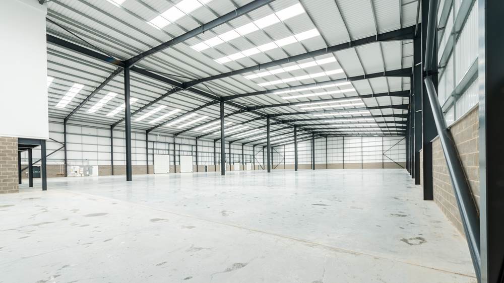
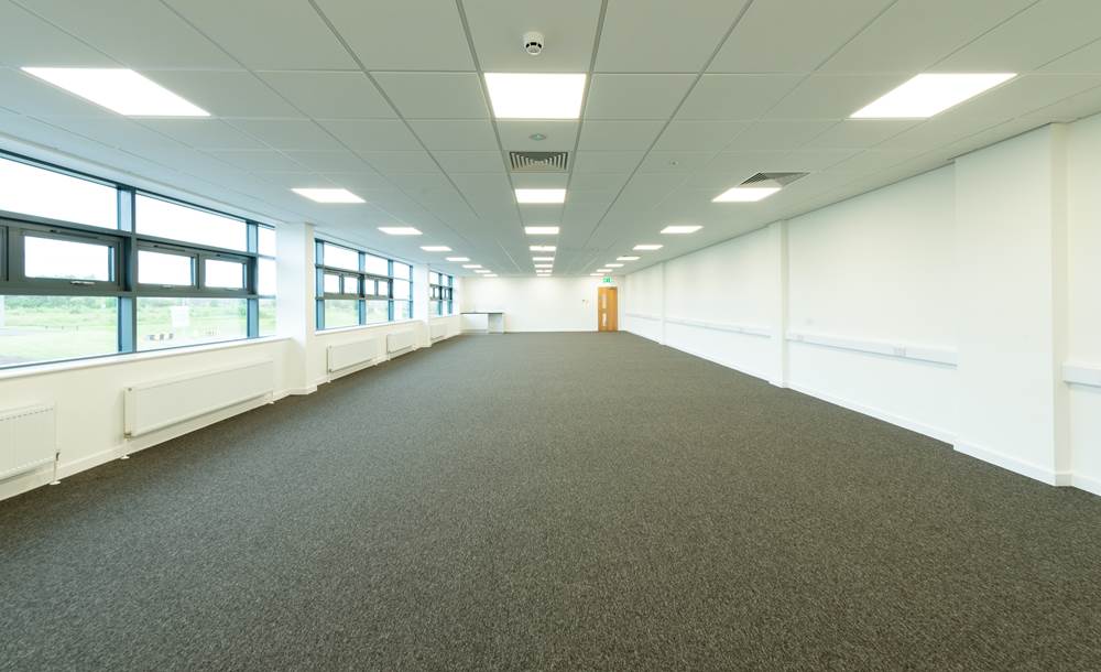
In 2008, Network Space delivered 60,000 sq ft of office space at the northern end of the site. In 2018 the development of 90,250 sq ft of high quality industrial floor space across 4 units, with unit sizes ranging from 18,500 – 26,350 sq ft completed, followed by a 51,800 sq ft unit as part of a pre-let deal with Synergy LMS, where a bespoke development was delivered for this commercial healthcare sector laundry firm.

Work has also completed on the final phase to deliver a 20,000 sq ft bespoke unit for Ormazabal, a specialist in electrical distribution equipment. 

Network Space also secured outline permission for residential development on the western side of Mere Grange which was subsequently sold to Anwyl Homes which is delivering in the region of 100 homes.

Mere Grange was developed in partnership with St Helens Council and Homes England.

Once 90% let, the site became a prime institutional investment opportunity. In September 2020, Network Space sold 162,000 sq ft site to an institutional investment partner. 

To see films of how Mere Grange evolved, please take a look at our YouTube channel: https://www.youtube.com/playlist?list=PLS9zq9d2Js4C0-QA79h6CZs4H8eQwmtVL 


Map

[ { "featureType": "water", "elementType": "geometry", "stylers": [ { "color": "#e9e9e9" }, { "lightness": 17 } ] }, { "featureType": "landscape", "elementType": "geometry", "stylers": [ { "color": "#f5f5f5" }, { "lightness": 20 } ] }, { "featureType": "road.highway", "elementType": "geometry.fill", "stylers": [ { "color": "#ffffff" }, { "lightness": 17 } ] }, { "featureType": "road.highway", "elementType": "geometry.stroke", "stylers": [ { "color": "#ffffff" }, { "lightness": 29 }, { "weight": 0.2 } ] }, { "featureType": "road.arterial", "elementType": "geometry", "stylers": [ { "color": "#ffffff" }, { "lightness": 18 } ] }, { "featureType": "road.local", "elementType": "geometry", "stylers": [ { "color": "#ffffff" }, { "lightness": 16 } ] }, { "featureType": "poi", "elementType": "geometry", "stylers": [ { "color": "#f5f5f5" }, { "lightness": 21 } ] }, { "featureType": "poi.park", "elementType": "geometry", "stylers": [ { "color": "#dedede" }, { "lightness": 21 } ] }, { "elementType": "labels.text.stroke", "stylers": [ { "visibility": "on" }, { "color": "#ffffff" }, { "lightness": 16 } ] }, { "elementType": "labels.text.fill", "stylers": [ { "saturation": 36 }, { "color": "#333333" }, { "lightness": 40 } ] }, { "elementType": "labels.icon", "stylers": [ { "visibility": "off" } ] }, { "featureType": "transit", "elementType": "geometry", "stylers": [ { "color": "#f2f2f2" }, { "lightness": 19 } ] }, { "featureType": "administrative", "elementType": "geometry.fill", "stylers": [ { "color": "#fefefe" }, { "lightness": 20 } ] }, { "featureType": "administrative", "elementType": "geometry.stroke", "stylers": [ { "color": "#fefefe" }, { "lightness": 17 }, { "weight": 1.2 } ] } ]